Last night, Will, Joel and I set out to cross a whole lot of bridges. We succeeded admirably, and managed in the process to (1) fall repeatedly in the mud, (2) drink a large quantity of gin and juice, and (3) take some pictures, which you can see after the jump.
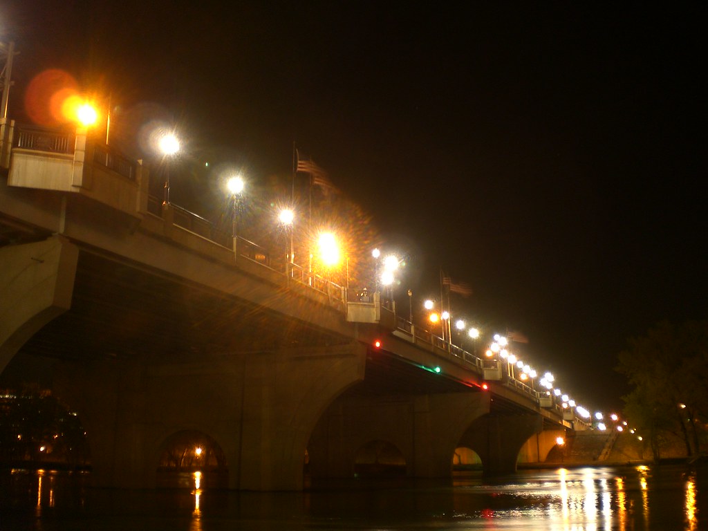
I won't bother to describe our route in great detail, aside from noting that we crossed the Charter Oak Bridge, the Founders Bridge, the Bulkeley Bridge, the railroad bridge north of the Bulkeley Bridge, the pedestrian bridge over I-91, and sundry other overpasses. Will's post on the ride will surely include all the information anyone could hope for about three drunks criss-crossing the Connecticut river on a Tuesday night. (We discussed the relative merits of duelling blog posts and collaborative blog posts. We agreed that when it comes to singing, collaboration is best, when it comes to freestyle rapping, battling is best, and banjos and blog posts are in the middle.) Anyway, here are the pics, which you can click on to see a larger version: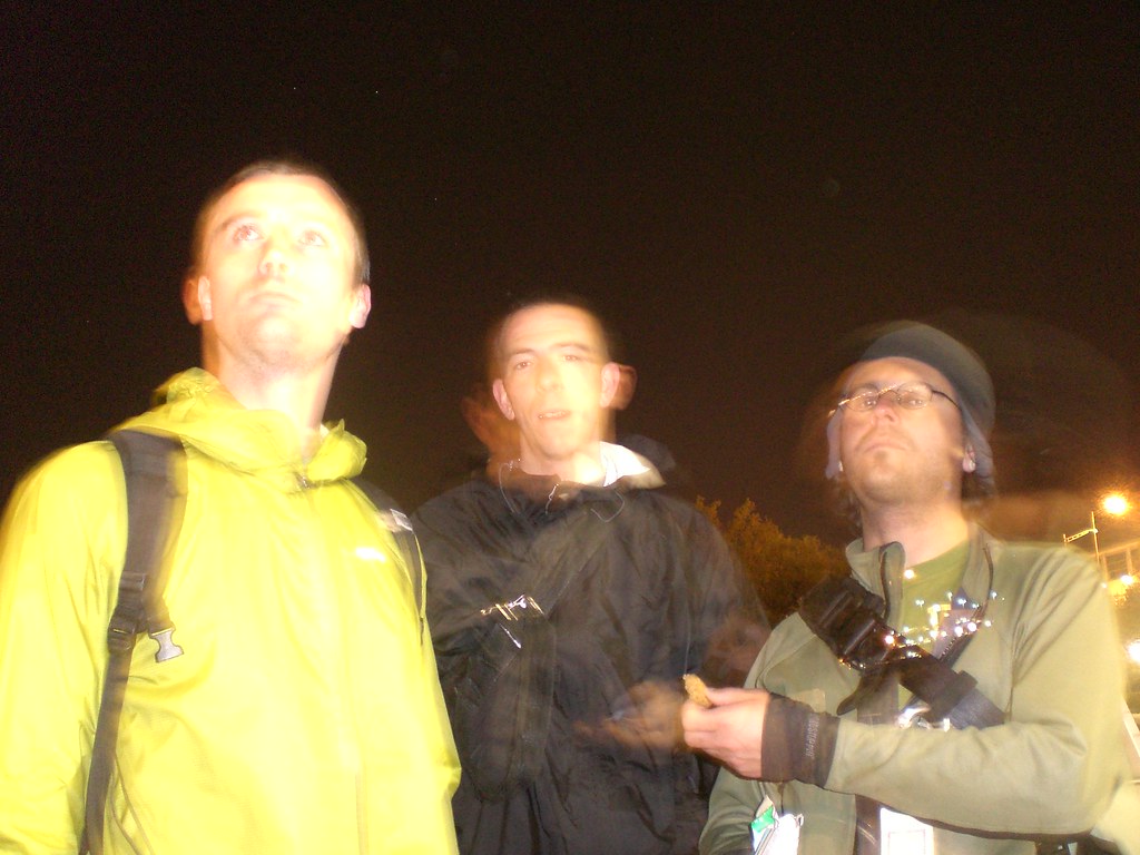
Luckily, I brought a tripod, so tender moments like the one shown above could be recorded for posterity.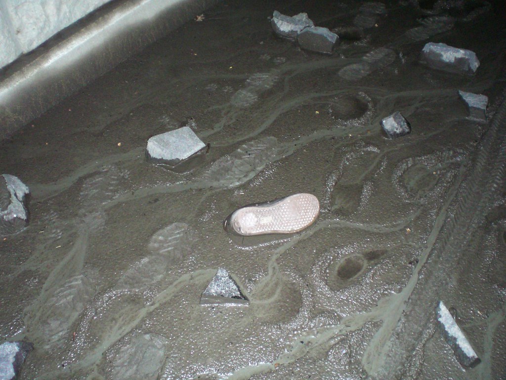
The walkway in Riverfront Park had a lot of river mud, which caused some sorry sucker who came before us to lose one sneaker.
I brought along a bottle of gin and juice, which we all enjoyed. In this photo, Joel has his mind on his money and his money on his mind.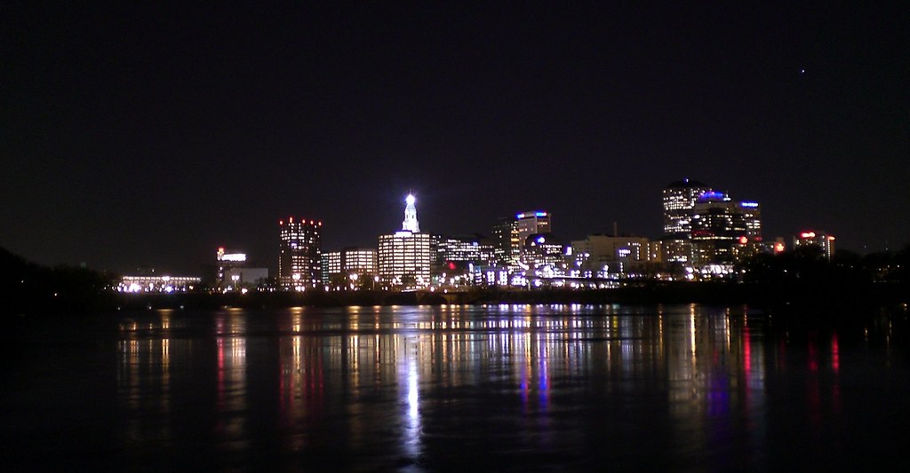
This is the lovely view of Hartford from the railroad bridge. If you want to enjoy this view yourself, I recommend getting off your bike and standing still to do so. There are a lot of large holes in the wooden walkway, and it would be foolish to take your eyes off the walkway while riding there.
Wednesday, April 30, 2008
Bridges!
Subscribe to:
Post Comments (Atom)

10 comments:
I bet you secretly wish that you were at a budget hearing like me.
I do secretly wish I was at a budget hearing, provided that my secret wish included gin and juice. Because I don't go to budget hearings without gin and juice.
I was thinking we should do another bridge-centric ride, but longer, and focused exclusively on railroad bridges. That ride would look like this.
doesn't that bridge in windsor locks have active trail traffic on it?
dangit!!! i can't see this map here!
and the htfd one has active traffic!
bridgefest 2008!
well if that's gonna be yer attitude, why ya gonna cross the farmington river on rt159 when there's a railroad bridge just upriver?
I thought, as I sat there in my wetsuit, gazing upward, I saw a shimmer of petina'd spokes and rusted cranks...didn't you know?...my tribe secretly skis the river at night...we'll be watching the river skies more closely from now on!!!
El Prez that route is my daily commute. I don't do the RR bridges I use the Founders Bridge and the Dexter's Bridge in Windsor Locks. Old Windsor is a nice stretch to ride through on 159.
speaking of bridges, here's an email about that bridge in granby (well, it's actually east granby) that I couldn't cross a couple of weeks ago.
1 May 2008
To: All Members of the Farmington Valley Trails Council
From: R. Bruce Donald, President
Subject: Salmon Brook Bridge, East Granby
Priority: URGENT
On the Fourth of July, 1825, more than 2,000 people gathered at Salmon Brook Village in Granby to celebrate ground breaking ceremonies for the eagerly anticipated Farmington Canal. By 1835, the canal was completed from New Haven to the Connecticut River in Northampton, MA. Using only hand tools, horses, and oxen and overcoming countless technical obstacles including the construction of a 280 foot aqueduct across the Farmington River, the Farmington Canal Company was able to complete this extraordinary undertaking in 10 years.
Fast-forward to the late 20th century. In 1992, the Farmington Valley Trails Council was founded to increase public awareness and support for the construction of a multi-use trail along the path of the old canal from Farmington to the Massachusetts border. Sixteen years later the trail is still not complete.
The last major gap in the trail is the Salmon Brook Bridge, a derelict 300-foot long railroad trestle in East Granby only a few yards south of RT 189 overlooking Granbrook Park. After years of repeated submissions to ConnDOT, a design to rehabilitate the bridge was finally approved and sent out to bid. Not surprisingly, all bids received on March 20, 2007 were substantially over budget and were rejected. The bridge was redesigned and in order to reduce costs, a number of attractive amenities were removed. After the revisions were approved by DOT, the bid package was once again sent out. On April 9, 2008, more than a year after the first bids were rejected, former East Granby Town Engineer, Charles Francis announced that the new low bid still exceeded the appropriation for the project by approximately $170,000.00. This amount remains an impossible per capita expenditure for a small town.
According to State regulations, the town has 45 days to accept or reject the bids. Working with the low bidder, East Granby was able to extend the deadline to August 1, 2008. If the bids are again rejected, the project must be revised, approved by DOT and sent to bid again with no guarantee that an acceptable bid would be forthcoming, perpetuating this cycle of delay in the face of massive cost increases.
The Farmington Valley Trails Council is doing everything in its power to close this funding gap. Although most of our local legislators are sympathetic to our cause, finding money at the state level is a time consuming task and funds are not likely to be available by the deadline.
As you may know, the Trails Council has established the “Salmon Brook Bridge Fund” and has raised $18,000 which we have matched with funds in our treasury for a total pledge of $36,000.00, leaving us $134,000.00 still to raise. We are canvassing the East Granby business community to help meet this challenge, but desperately need the support of all of our members and friends to insure the completion of this marvelous resource.
We are only 300 feet from having a continuous twenty-one mile paved trail from Farmington to Suffield. Be a “Bridge Builder” and send your donation to the Farmington Valley Trails Council, P.O. Box 576, Tariffville, CT 06081. Please make your check payable to the “Farmington Valley Trails Council”. We are a 501(c)(3) corporation and your contribution may be tax deductible, but be sure to consult your tax advisor before taking the deduction. Any questions may be directed to R. Bruce Donald at 677-9462 or Dwight D. Weed at 242-1383.
_______________________________________________
Fvtc mailing list
Fvtc@host.geeberry.com
http://host.geeberry.com/mailman/listinfo/fvtc
Obviously, we need to sneak in and pave the derelict railroad bridge overnight. How hard can that be, right? Nocturnal guerrilla bikepath improvement is totally the wave of the future.
Also, Chillwill, my route goes off 159 so it can take the railroad bridge over the Farmington River. Naturally, this is less efficient than just taking the roads, but it's not about efficiency. It's about bridges, and the romance of rail travel, and so on and so forth.
What we really need to do is go down to Middletown with some boats so we can get up on the railroad bridge there (downriver from the Arrigoni Bridge that Rte 66 crosses). I don't know what we would do once we were on the bridge (aside from shoot a video for a Billy Joel song, which has already happened there), but it would be fun.
maybe we should hoist a flag!?! shout and scream? declare war on cars? pee on motorboats?
who knows? i dunno. but what i do know, is we need to design a flag apparently.
Post a Comment